
Which Oregon place or course fits each stage?
So here is one pick per stage. Each row links to the full section below, where I give two or three options spread across the state.
| Stage | One Oregon pick | Why this one |
|---|---|---|
| 1. One-mile hike | Silver Falls State Park, North Rim Trail | Wide, nearly flat packed gravel out to a view of North Falls. The Stage 1 section has a short walk near every part of Oregon. |
| 2. Five-mile hike | Upper Table Rock | About 3 miles round trip and 740 feet of steady climbing, with wildflowers in April and May. |
| 3. Ten-mile hike | Strawberry Mountain | A long summit day in eastern Oregon, about 12.6 miles round trip past Strawberry Lake. |
| 4. Elevation | Mount Scott, Crater Lake | An evenly graded 1,250 foot climb to Crater Lake's high point at 8,929 feet. |
| 5. Overnight trip | Green Lakes, Three Sisters Wilderness | About 4.5 miles in past waterfalls, with a $6 per group overnight permit and a pass at the lot. |
| 6. First walk-up peak | South Sister | A 10,358 foot summit with no rope, but about 5,000 feet of climbing over 12 to 13 miles. |
| 7. Snow and glacier skills | Kaf Adventures Mt. Hood Skills Course | $299 for one day of crampon, ice axe and self-arrest practice, and it is not a summit climb. |
| 8. Guided bigger peak | Timberline Mountain Guides Mount Hood Summit Program | $1,175 per person in an open group, with 3 climbers per guide at most. |
| 9. Everest | What it costs to climb Everest | Everest is the same for everyone, wherever you live. |
How do I read this page?
Basically, three kinds of statements show up here, and I keep them apart.
- Safety information comes from a government agency or a mountain rescue group. The agencies include the US Forest Service, the National Park Service, the Bureau of Land Management (BLM) and the CDC. I name the agency and link its page right next to the statement.
- The nine stages are my suggested ladder from my start mountaineering from zero guide. No safety body publishes the ladder, so it is my suggestion, not a safety rule.
- Opinion is labeled as opinion, whether it is mine, a guide company's or a club's.
Now keep in mind that nobody can promise you will reach any summit. Trail distances and climbing figures vary a little between maps and GPS tracks, so where they differ I give the range.
And when two sources disagree, I say so right where it happens. No official page publishes rescue or death counts for South Sister, so this page doesn't give any.
What should I check before any trip in Oregon?
- Check wildfire and closure information the day before and again that morning. Fire restrictions and closures can appear at short notice. Start with the alerts page of the national forest you are visiting and with InciWeb, the national incident site.
- Carry the Ten Essentials. They are navigation, sun protection, extra clothing, a light, first-aid supplies, fire, a repair kit and tools, extra food, water and a way to treat it, and emergency shelter.
- Know which pass you need. The Forest Service sells a Northwest Forest Pass for $30 a year and a $5 day pass, good at Forest Service day-use sites in Oregon and Washington. Oregon State Parks sells day-use parking permits at $10 for Oregon residents and $12 for everyone else. From November 1 to April 30, the Oregon Department of Transportation requires a Sno-Park permit at winter parking areas called Sno-Parks. The Sno-Park permit costs $4 a day, $9 for three days or $25 a year, and sellers may add a service fee.
- Tell someone your route and when you will be back. The Forest Service's Mount Hood climbing page says that if you are overdue, that person should call 911.
My guides on how to layer for a mountain and boots, shoes or trail runners cover clothes and feet. This page does not cover water treatment or cold nights.
What wildlife and plants should I know about on Oregon trails?
So the short answer is that serious trouble from an animal or a plant is rare on Oregon trails. The things you're most likely to actually meet are poison oak, ticks and mosquitoes. Rattlesnakes, black bears and cougars live here too, but a bite or an attack is unusual. Here's where each one lives, what time of year to watch for it, and what to do, so you and your kids know before you go.
| Animal or plant | Where in Oregon | When to watch for it | How likely it is |
|---|---|---|---|
| Rattlesnakes | Dry, rocky country: Southern Oregon, the east side of the Cascades, the east end of the Columbia River Gorge and most of eastern Oregon. | Spring to early fall. On hot summer days, mostly at dawn, dusk and night. | You may see a rattlesnake on dry southern and eastern trails. Bites are uncommon, and deaths are rare. |
| Ticks | Grass and brush statewide. The tick that carries Lyme disease lives mostly west of the Cascades. | Spring and summer. | Ticks are common in grassy oak country. Lyme disease caught in Oregon is rare, about 2 or 3 cases a year. |
| Poison oak | Lower trails west of the Cascades, like the Table Rocks, the Willamette Valley oak woods and the western Columbia River Gorge. | All year. The bare winter stems still carry the oil. | Poison oak is very common on several trails on this page. |
| Black bears and cougars | Black bears live throughout Oregon. Cougars do too, with the most in northeast and southwest Oregon. | Cougars are most active at dawn and dusk. | Attacks are rare. Oregon has had one known attack by a wild cougar. |
| Mosquitoes, yellowjackets and spiders | Mosquitoes swarm near mountain lakes. Yellowjackets nest in the ground statewide. | Mosquitoes in June and July up high. Yellowjackets in late summer and early fall. | Mosquitoes and yellowjackets are common. West Nile virus is rare in Oregon. |
Where are rattlesnakes in Oregon, and what do I do if one bites?
Basically, the western rattlesnake is the only snake in Oregon with venom that's dangerous to people. Adults in Oregon average about 2 feet long, with a broad, triangular head that's wider than the neck, and a rattle on the tail.
Rattlesnakes live in dry, open, rocky country. The Oregon Department of Fish and Wildlife (ODFW) range covers the Klamath Mountains of Southern Oregon, around Medford and Grants Pass. It covers the east side of the Cascades and the southern end of the Coast Range too. And it covers the dry Columbia Plateau at the east end of the Columbia River Gorge, the Blue Mountains and the high desert of southeast Oregon.
Now here's where you're unlikely to meet one. ODFW knows of only three small rattlesnake sites left in the Willamette Valley. Portland and the north coast aren't in the rattlesnake range at all. And in Oregon, rattlesnakes generally aren't found above 7,000 feet, so you won't meet one on the upper slopes of the big summit climbs on this page.
Rattlesnakes are out from spring until they head back to their winter dens in September and October. In the heat of summer, they move mostly at dawn, at dusk and at night. In milder spring and fall weather, they're out during the day too. And on a hot afternoon they hide in shade, under rocks and ledges.
So how likely is a bite? The CDC estimates that 7,000 to 8,000 people a year are bitten by venomous snakes across the whole US, and about 5 of them die. Rattlesnakes usually crawl away or stay hidden unless they're surprised. So keep your distance, and watch where you put your hands and feet.
If someone is bitten, here's what the CDC and the Oregon Poison Center say to do:
- Call 911, or call Poison Help at 1-800-222-1222, which reaches the Oregon Poison Center. Get medical help right away, and don't wait for symptoms to show up.
- Move away from the snake. Keep the person calm and still, sitting or lying down.
- Take off rings, watches and tight clothing before the swelling starts.
- Wash the bite with soap and water if you can, and cover it with a clean, dry dressing.
- Write down the time of the bite. The CDC also suggests marking the edge of the swelling on the skin, with the time next to it.
- Don't let the person drive themselves to the hospital, because the CDC says a snakebite can make you dizzy or pass out.
And here's what the CDC and the Oregon Poison Center say not to do:
- Don't cut the bite, and don't try to suck out the venom.
- Don't use a tourniquet.
- Don't soak the bite in ice or ice water.
- Don't try to catch or kill the snake. The CDC says never to handle a venomous snake, not even a dead one.
- Don't give alcohol or pain relievers like aspirin, ibuprofen or naproxen. That's from the CDC.
For kids, I'd keep the rattlesnake rules simple. Stay on the trail, and look before you step over a log or sit on a rock. Never reach into a crack or under a ledge you can't see into. If you see or hear a rattlesnake, stop, give it plenty of room and go around it slowly. And never poke, chase or pick up any snake.
Where are ticks in Oregon, and how worried should I be about Lyme disease?
Ticks wait on tall grass and brush and grab on as you brush past. Some are as small as a sesame seed, so they're easy to miss. The tick that carries Lyme disease in Oregon is the western black-legged tick. The Oregon Health Authority says it lives mostly west of the Cascades, including Hood River County, and its young nymphs feed in spring and summer.
Now the good news. The Oregon Health Authority counted 12 cases of Lyme disease caught in Oregon from 2022 to 2025, a median of about 2.5 a year. And a tick usually has to stay attached for 36 to 48 hours or more before it can pass on Lyme disease. So a good tick check after each hike really does protect you.
The CDC's tick bite steps are these:
- Use an EPA-registered insect repellent, and treat clothes and gear with products containing 0.5 percent permethrin.
- Walk in the center of the trail, away from the grass and brush on the edges.
- After the hike, check your whole body and your kids' bodies. Look under the arms, in and around the ears, in the hair, in the belly button, behind the knees, between the legs and around the waist.
- Shower within two hours of coming inside, which the CDC says lowers the risk of Lyme disease.
If you find a tick attached, the Oregon Poison Center says to grab it with tweezers as close to the skin as you can. Then pull it straight out with a steady pull. Don't crush or burn the tick, or cover it in petroleum jelly. Then clean the spot with soap and water. And if a fever, headache, tiredness or a bull's-eye rash shows up in the next few weeks, call a doctor and mention the tick bite.
How do I spot poison oak, and what if we touch it?
Poison oak is the plant you'll run into most on the lower trails on this page. It grows thick at Upper Table Rock near Medford, Bald Hill in Corvallis and Dorris Ranch in Springfield. It also crowds the upper part of the Angels Rest trail in the Gorge. The rash comes from an oil in every part of the plant, including the leaves, stems and roots.
So here's how to spot poison oak. The leaves come in groups of three, and they're often shiny. Poison oak can grow as a shrub, as a vine climbing a tree, or as a single bare stick. New leaves come out a shiny red-green in spring, and the leaves turn yellow and red in fall. In winter poison oak can be just bare stems, and those stems still carry the oil.
To avoid poison oak, stay on the trail and wear long pants, long sleeves and closed-toe shoes. For kids, the old saying works fine: "leaves of three, let it be."
If you think you touched poison oak, the Bureau of Land Management (BLM) says to wash with cool, soapy water as soon as you can. The CDC suggests dish soap and plenty of water, rinsing often, and scrubbing under your fingernails. The oil sticks to clothes, shoes and dog fur, so wash those too, and keep those clothes out of the rest of the laundry. Never burn poison oak, because the CDC warns the smoke can cause serious breathing problems. The CDC says to get medical help for a severe rash or a rash on the face or genitals. And call 911 for swelling or trouble breathing.
Will we see a black bear or a cougar, and what do we do if we do?
Oregon has about 25,000 to 30,000 black bears, living all over the state. It also has more than 6,000 cougars, with the most in the forests, canyons and mountains of northeast and southwest Oregon. Both animals usually sense people and leave first.
ODFW calls black bear attacks rare and cougar attacks on people extremely rare. Oregon has had one known attack by a wild cougar, and it was fatal. That was a hiker near Mount Hood in 2018.
To lower the chances of a surprise, ODFW's advice on its black bear and cougar pages is this:
- Hike in a group and make some noise as you go.
- Keep children close to you, and keep dogs on a leash.
- Be extra alert at dawn and dusk, when cougars are most active, and don't hike after dark in bear country.
- Carry bear spray and practice using it. ODFW says bear spray works on cougars too.
- Stay far away from cubs and other baby animals, because the mother is nearby.
- On an overnight trip, store food in animal-proof containers, and sleep at least 100 yards from where you cook and eat.
If you meet a black bear, ODFW says to stay calm and don't run. Avoid eye contact, and back away slowly while facing the bear. Step off the trail so it has a way to leave. If a bear stands up on its back legs, it may just be trying to pick up your scent.
If you meet a cougar that doesn't leave, ODFW says not to run, because running can make a cougar chase you. Keep eye contact, and pick up small children without bending down or turning your back. Then raise your arms to look bigger, speak firmly or yell, and back away slowly.
Something to note is that eye contact is the one big difference. ODFW says to avoid eye contact with a black bear but keep it with a cougar. And if either animal ever attacks, ODFW says to fight back with anything you have, like sticks, rocks or bear spray.
What about mosquitoes, yellowjackets, spiders and stinging nettle?
Mosquitoes are mostly a nuisance on these trails. They swarm near mountain lakes and in the forest below treeline in June and July, at places like Mount McLoughlin, Green Lakes and the Wallowa lakes. Above treeline and by September, there are far fewer.
Now mosquitoes can carry West Nile virus, but it's rare in Oregon. The Oregon Health Authority counted no human cases so far in 2026. Its August 2023 release reported 5 human cases in 2021 and 5 in 2022. In 2023, most of the infected mosquitoes it found were in Baker and Malheur counties in eastern Oregon.
The Oregon Health Authority suggests a repellent with DEET, picaridin or oil of lemon eucalyptus, plus long sleeves and long pants. Mosquitoes bite most at dawn and dusk. Adults 50 and older and people with weak immune systems are more likely to get seriously sick from West Nile.
Yellowjackets build their nests in the ground, and Oregon State University Extension says the colonies peak in late summer and early fall. A yellowjacket can sting again and again while defending its nest. So if you see wasps flying in and out of a hole by the trail, go around it, and if you disturb a nest, move away fast.
Most stings just hurt and swell. But the Oregon Poison Center says anyone allergic to stings should get medical help right away. Hives, itching, flushed skin and trouble breathing are signs of a severe reaction.
Black widow spiders hide under rocks, around stumps, in holes in the ground and in woodpiles. They seldom bite people. A black widow bite can cause painful muscle cramps, belly pain and sweating. The Oregon Poison Center says to wash the bite with soap and water and call Poison Help at 1-800-222-1222.
Stinging nettle grows along damp, shady parts of several Portland and Willamette Valley trails, including Powell Butte, Minto-Brown and Dorris Ranch. Brushing bare skin against stinging nettle stings and itches for a while, so long pants help.
What should I teach my kids before an Oregon hike?
- Stay on the trail and stay where a grown-up can see you.
- Look before you step over a log or sit on a rock, and never reach into a spot you can't see.
- Leaves of three, let it be.
- Never touch, chase or feed a wild animal, even a small one or a dead one.
- If you see a big animal, don't run. Stand still and call a grown-up.
- After every hike, everyone gets a tick check.
So ultimately, none of this is a reason to stay home. Wear long pants on brushy trails, carry repellent, stay on the trail, keep kids close, and do a tick check at the end of the day.
Stage 1: Where can I take my first one-mile hike in Oregon?
This is Stage 1, the one-mile hike: a short, easy walk on a marked path. And since the walk is that short, there's no reason to drive three hours for it. Find your part of Oregon below and pick the walk closest to home.
Portland, Gresham, Beaverton and Hillsboro
- Forest Park, Portland. Start at Lower Macleay Park on NW Upshur Street. The first 0.2 mile of the Lower Macleay Trail is smooth pavement with a gentle grade, ending at a stone viewing spot over Balch Creek. That viewing spot is the place to turn around with a stroller or wheelchair, because right after it the trail turns to steep dirt with roots and loose rock. For a full mile or more, keep going on the dirt trail to the old Stone House, about 0.9 mile in. The Upshur Street lot only holds about 6 to 8 cars and fills on weekends, so plan to park on the nearby streets. Forest Park is open from 5 am to 10 pm and free to park. Wind, rain and high water can close trails, so check the city's trail closures page before you go.
- Powell Butte Nature Park, east Portland near Gresham. The paved Mountain View Trail climbs gently from the visitor center to the summit viewpoint, about 1.5 miles there and back. From the top you can see Mount Hood, Mount St. Helens and Mount Adams on a clear day. Because the Mountain View Trail is paved, a stroller rolls up it fine. Parking at 16160 SE Powell Boulevard is free, but the lot fills on sunny weekends, so go early. The gate opens at 7 am and closes at 8 pm in fall and 6 pm in winter, and it can stay shut when the road is icy. There's an accessible restroom at the visitor center. Keep dogs leashed, and expect bikes and horses on the trails. And keep in mind the top of Powell Butte is windy, so bring a layer even on a nice day. Stinging nettle grows beside parts of the Powell Butte trails, so long pants help.
- Tualatin Hills Nature Park, Beaverton. About 1.5 of the park's 5 miles of trail are paved, and the paved Oak Trail and part of the Vine Maple Trail work for strollers and wheelchairs. For about 2 miles, loop the Vine Maple, Old Wagon and Oak trails. That loop is close to flat. The dirt part of that loop gets muddy in winter and spring, so stay on the paved trails then. Parking at 15655 SW Millikan Way is free, and the MAX Blue Line stops at Merlo/SW 158th, a short walk away. There are restrooms by the Nature Center, and Tualatin Hills Nature Park is open dawn to dusk. Something to note is that the Tualatin Hills Park & Recreation District doesn't allow dogs there at all, to protect the wildlife. Tualatin Hills Nature Park is busy on nice days. And it's about 15 minutes from Hillsboro.
Salem
- Minto-Brown Island Park, Salem. Minto-Brown is about as flat as a park gets, with miles of mostly paved paths along the Willamette River. For a first mile, walk out from Lot 1 on the paved path and turn around whenever you want. Parking at 2200 Minto Island Road SE is free, and there's a 30-acre off-leash area for dogs. Everywhere else, dogs stay leashed. Restrooms are mostly portable toilets near the lots. Minto-Brown gets busy on nice weekends. In winter, high water can flood some of the Minto-Brown paths. So then, start from Lot 3, because the trails there stay drier. Stinging nettle grows along some of the Minto-Brown paths, so long pants help.
- Silver Falls State Park North Rim Trail, near Salem. The North Rim Trail opened in 2023, and it's 6 feet wide, packed gravel and nearly flat, with a grade under 5 percent. It runs from the North Canyon Day-Use Area to a viewpoint over North Falls. Strollers roll along it easily, and wheelchair users should start from the North Canyon end, since the North Falls Trailhead end is rougher. The state park page gives one mile, while the 2023 opening announcement gave half a mile to the overlook, so plan on somewhere between the two. Silver Falls is about 45 minutes from Salem. The park is open for day use all year, though the gate hours change by month. Parking costs $10 for Oregon residents and $12 for others.
Eugene and Springfield
- Delta Ponds Loop, Eugene. The Delta Ponds Loop is a flat 1.4 to 1.5 mile gravel loop around ponds full of birds, with a boardwalk and viewing platforms. A footbridge finished in 2024 closed the last gap in the Delta Ponds Loop, so now you can walk all the way around. The loop has no steps, so strollers and wheelchairs handle it fine. Park off Goodpasture Island Road for free, but the lots are small. Keep your dog leashed. You'll hear road noise, and some spots get muddy after rain. And keep in mind Eugene closes parts of the Delta Ponds Loop for a while when the water runs high.
- Dorris Ranch, Springfield. The Dorris Ranch loop is about 2 miles and basically flat, through old filbert orchards and woods by the Middle Fork Willamette River. It starts on pavement, then turns to gravel, dirt and wood chips. So a stroller does best on the paved start and the paved Middle Fork Path that starts at Dorris Ranch. The Dorris Ranch lot is big and free, and there are real restrooms. Keep dogs leashed. Dorris Ranch is open dawn to dusk, and it's busy on sunny weekends. Watch for nettles and poison oak beside the trail, and expect the low ground by the river to flood after heavy rain.
Corvallis and Albany
- Bald Hill Natural Area paved path, Corvallis. Stay on the paved path along the bottom of Bald Hill. It's 10 feet wide and never steeper than 3.5 percent, so strollers and wheelchairs manage it fine. From the Oak Creek Drive trailhead out to the Bald Hill Barn and back is about a mile. Keep going toward Reservoir Road for 2 miles or more. Parking is free, with 28 spaces at Oak Creek Drive and a bigger lot at the Benton County Fairgrounds. There's no restroom at the trailhead, just a portable toilet near the barn. The Bald Hill paved path has little shade. And it's often busy, with bikes sharing it. Keep dogs leashed, and stay clear of the poison oak beside the trail. Bald Hill is about 20 minutes from Albany.
Bend, Redmond and Central Oregon
- Deschutes River Trail, Old Mill District, Bend. The Old Mill stretch of the Deschutes River Trail is wide, paved and close to flat. Three footbridges cross the river, so you can make a loop as short as about 1.1 miles. Strollers do fine on the paved part, but past the Farewell Bend footbridge the trail turns to gravel. Park free at Riverbend Park, which has year-round restrooms, but that lot fills on warm summer days. Bend's park trails are open 5 am to 10 pm, and dogs stay leashed. Something to note is that Bend Park & Recreation is closing Columbia Park and the Gilchrist Bridge for construction from October 19, 2026 to early summer 2027. The Old Mill stretch is popular, so expect people on nice days.
- Pilot Butte, Bend. Pilot Butte is short but steep, so think of it as a step up from the Deschutes River Trail. The summit trail is about a mile up with about 500 feet of climbing, on dirt and cinder after a paved start. And from the top you can see the Cascades. Parking at the east side base lot is free, and there are restrooms at the bottom and the top. There's almost no shade, so go early on summer days. Dogs need a leash no longer than 6 feet. Pilot Butte had about 1.2 million visits in 2023, more than any other Central Oregon state park, so it's always busy.
- Dry Canyon Trail, Redmond. The Dry Canyon Trail is a paved, nearly flat path that runs about 4 miles through a canyon right in town. For a first walk, start at Bowlby Park and go out and back as far as you like. Parking is free, with portable toilets at the trailhead and a water fountain at the Maple Avenue Bridge. Keep dogs leashed, or use the fenced off-leash areas at the Antler Avenue trailhead. Dry Canyon is mostly open high desert, so summer afternoons get hot. The Dry Canyon Trail is rarely crowded. Redmond has had construction in the middle of Dry Canyon, so check the city's Dry Canyon Trail page for detours first.
- Painted Hills Overlook Trail, John Day Fossil Beds, a day trip from Bend. The Painted Hills Overlook Trail is a 0.5 mile round trip on a wide dirt track along an old road, with a gentle climb and a few benches. Other short Painted Hills trails there include Painted Cove, a boardwalk over the colored clay, plus Leaf Hill and Red Scar Knoll, at about 0.25 mile each. The colors look best in the afternoon and evening light. There's almost no shade, and summer days can pass 90 degrees, so spring and fall are the comfortable seasons. After rain or snow, the clay turns into sticky mud. The Park Service doesn't allow walking on the hills, because footprints stay in the clay for years. Rattlesnakes and black widow spiders live in the John Day Fossil Beds, so watch where you put your hands and feet, especially in shady spots. The Painted Hills are about 1.5 hours from Bend, and there's no entrance fee.
Medford, Ashland and Grants Pass
- Lithia Park, Ashland. Lithia Park follows Ashland Creek uphill from the Plaza, about 20 minutes from Medford. For a first walk, follow the paved and gravel paths along the creek to the ponds and back, about 1 to 1.5 miles. The lower paths are shady and fine for a stroller, with some steps farther up. Parking is free, but the lots by the Plaza fill by late morning, so try Granite Street. There are restrooms year round. Dogs aren't allowed in Lithia Park, except service dogs, and Ashland's fine for a dog in Lithia Park is $115. Lithia Park is often busy. And early and late in the day, you'll see deer and wild turkeys. Watch for poison oak off the path.
- Reinhart Volunteer Park to Tussing Park, Grants Pass. The flat, paved Reinhart to Tussing loop crosses the Rogue River on a footbridge between Reinhart Volunteer Park and Tussing Park, about 1.7 miles around. You'll pass ponds with ducks and geese. Park at 1690 SW Webster Road, where there are restrooms. Something to note is that the Rogue River footbridge locks at night. From November 1 to the end of February it's locked 7 pm to 6 am, and the rest of the year 11 pm to 5 am.
Klamath Falls
- Link River Trail, Klamath Falls. The Link River Trail is a flat gravel service road, closed to cars, along the river between Upper Klamath Lake and Lake Ewauna. From the south trailhead to the rapids and back is about 1.2 miles, and the whole trail is about 1.5 miles each way. Park free in the lot off Main Street behind the Favell Museum. There's no restroom at that south end, only at Putnam's Point at the far north end. A sturdy stroller handles the gravel. Keep dogs leashed. Pelicans show up in summer. And the Link River Trail is rarely crowded. Keep in mind Pacific Power owns the land and can close parts of the trail for canal work, as it did from March 17 to April 11, 2026.
- Moore Park Nature Trail, Klamath Falls. The Moore Park Nature Trail is a 1.1 mile dirt loop with about 155 feet of climbing. Signs along the way tell you about the plants. You come back on a paved road that's closed to cars. Park at the tennis court lot at 740 Lakeshore Drive, near the restrooms. Keep dogs leashed. Moore Park is popular, and mountain bikers use its trails a lot.
Roseburg
- Stewart Park, Roseburg. The paved loop around the Stewart Park duck pond is flat and about 1.6 to 2 miles. There are shorter routes too, like the 0.5 mile Fir Grove Route and the 1.2 mile Deer Creek Route. Parking at the duck pond trailhead off Goetz Street is free. And there are restrooms there and at the riverfront trailhead. Keep dogs on a leash 8 feet or shorter. Stewart Park is busy on nice weekends, and the stretch by I-5 is loud. If you want a longer walk, go out and back on the paved South Umpqua riverfront path and turn around when you're ready.
The coast: Newport, Coos Bay and Astoria
- Yaquina Head Lighthouse Trail, Newport. The Lighthouse Trail is paved and easy, about 15 minutes each way from the Interpretive Center to the Yaquina Head Lighthouse. Its steepest bit is an 11 percent grade. The other trails at Yaquina Head, like Quarry Cove and Salal Hill, are steeper, so start with the Lighthouse Trail. The Bureau of Land Management charges $7 per car for a 3-day pass. There are accessible restrooms at the Interpretive Center and the lighthouse lot. Dogs can come on a 6-foot leash, but not near the lighthouse or in the tide pools. Yaquina Head is windy even in summer. And the lots get busy, so arrive early. Whales pass in winter and spring.
- Shore Acres State Park, near Coos Bay. Shore Acres is about 13 miles from Coos Bay. The short walk goes from the lot to the clifftop observation building, along the cliff path and through 7 acres of gardens on flat gravel paths. And you can turn around anywhere, so the Shore Acres walk can be as short or as long as you want. The steep steps down to Simpson Beach are optional. Parking at Shore Acres needs an Oregon State Parks day-use parking permit. Dogs aren't allowed outside your car anywhere in Shore Acres. Something to note is that for the Shore Acres Holiday Lights, from November 26 to December 31, 2026, you must buy timed entry and parking ahead. The Shore Acres garden flowers bloom from February to mid-October.
- Netul River Trail, Fort Clatsop, near Astoria. The Netul River Trail runs about 1.25 to 1.5 miles one way from the Fort Clatsop visitor center to Netul Landing. Fort Clatsop is about 5 miles from Astoria. The trail is mostly flat gravel, concrete and boardwalk, with one steep bit by the visitor center. Walk out as far as you like and come back. In the rainy season the Netul River Trail gets muddy and can flood, and downed trees sometimes block it. The Park Service charges $10 per person aged 16 and up, good for 7 days. Leashed dogs are welcome, and there are restrooms at the visitor center and pit toilets at Netul Landing. The visitor center lot gate closes at 5 pm in winter and 6 pm in summer.
Eastern Oregon: Pendleton, La Grande and Baker City
- Pendleton River Parkway, Pendleton. The Pendleton River Parkway is a flat, paved path along the levee on the Umatilla River, about 2.6 miles long. For a first mile, start at Roy Raley Park and walk out and back. Roy Raley Park at 1205 SW Court Avenue has a free lot and restrooms. Leashed dogs are fine, and strollers and wheelchairs roll along the parkway easily. Summer afternoons get hot, so go early in the day.
- Oregon Trail Interpretive Park at Blue Mountain Crossing, near La Grande. The Blue Mountain Crossing park is run by the Forest Service, about 13 miles west of La Grande. Its half-mile paved loop goes past real Oregon Trail wagon ruts. The loop has benches and signs, and it works for wheelchairs. Keep in mind Blue Mountain Crossing only opens in summer, roughly late May to early fall, and it needs a day pass or a Northwest Forest Pass. Call the La Grande Ranger District at 541-963-7186 for this year's dates.
- Leo Adler Memorial Parkway, Baker City. The Leo Adler Memorial Parkway is a flat, paved path that runs about 2.6 miles from downtown north along the Powder River. The parkway works for walkers and wheelchairs, with lots of benches along the way. Park free at the Baker County Public Library, 2400 Resort Street. Geiser-Pollman Park, on the parkway, has restrooms.
You're ready for Stage 2 when you finish the mile feeling you could do more, and your legs and feet feel fine the next day. That check is my own suggestion.
Stage 2: Where can I build up to a five-mile hike in Oregon?
This is Stage 2, the five-mile hike: about 5 miles with a few hundred feet of climbing.
- Upper Table Rock, near Medford. Since a 2023 reroute, the Upper Table Rock trail is about 1.5 miles each way to the top, so about 3 miles round trip with about 740 feet of climbing. Walking out to the viewpoints on the flat top makes it closer to 4 miles. The trail is gravel lower down, then rocky and uneven near the top. On the flat top, stay outside the fences around the vernal pools, which hold rare fairy shrimp. Upper Table Rock is about 20 minutes from Medford, and April and May are the wildflower months. The lot holds about 15 cars and fills on spring weekends, while fall days are much quieter. Dogs aren't allowed at the Table Rocks. Bring water, because there's none on the trail and little shade in summer. Poison oak grows all along the Upper Table Rock trail and even on top, so stay on the trail. Ticks are common in the grass there, so check everyone for ticks afterward. You might see a rattlesnake, but the Table Rocks rattlesnakes are rarely aggressive, so give one room and ease around it. The trail gets slick and muddy after rain. Parking is free.
- Angels Rest, Columbia River Gorge. Angels Rest is about 4.8 miles round trip with about 1,475 feet of climbing, which is more than a typical Stage 2 day. The trail climbs steady switchbacks through forest burned in the 2017 Eagle Creek Fire, then crosses a rocky slope of loose stones near the top. The second half has little shade. Angels Rest is about 30 minutes from Portland at exit 28, and it's open all year. The top is an open cliff edge with no railings, and the Forest Service warns hikers to use extreme caution there, because people have died in falls. East winds can be fierce up top in fall and winter, so bring a wind layer. Since March 30, 2026, Oregon State Parks has charged $10 a day for residents and $12 for others to park at the Angels Rest Trailhead. On weekends, get there before about 8:30 am to find a spot in the main lot. There's no drinking water and no toilet at the trailhead. Poison oak crowds the upper part of the Angels Rest trail, so wear long pants and keep kids in the middle of the path. Skip Angels Rest on icy or very wet days, because the clay on the trail gets slick.
- Misery Ridge loop, Smith Rock State Park, near Bend. The Misery Ridge loop is about 4 miles with about 950 feet of climbing. Almost all of that climbing comes in the first stretch, up steep switchbacks and big steps to the ridge. The way down passes Monkey Face, a 350 foot rock spire, on loose, dusty switchbacks, so grippy shoes and poles help. There's almost no shade, and summer days can reach the 90s, so start early. Rattlesnakes are common near the Crooked River, so watch where you step and sit, especially in the shade under the rocks. Smith Rock is about 40 minutes from Bend, and the park is open dawn to dusk. Parking is $10 a day for Oregon residents and $12 for others, paid at the kiosk, and the lots fill on summer and holiday weekends. From December 1, 2026 to May 31, 2027, construction will close parts of the Rim Rock and North Point Loop trails at times. Part of the overflow lot closes too.
You're ready for Stage 3 when 5 miles feels steady, and you can do it two weekends in a row. That check is my own suggestion.
Stage 3: Where can I work up to a ten-mile hike in Oregon?
This is Stage 3, the ten-mile hike: about 10 miles with real climbing and a loaded daypack. My guide on knee pain going downhill helps if the descent hurts.
- Trail of Ten Falls, Silver Falls State Park. The Trail of Ten Falls loop runs about 7.2 to 8.7 miles, with about 800 to 1,300 feet of climbing. The total depends on where you start and which side trails you take. The Trail of Ten Falls is short of 10 miles, so it's a good stepping stone from Stage 2. You walk behind four of the waterfalls, and the spray behind South Falls and Lower South Falls makes the rock slick and soaks you. There are long staircases down to Lower South Falls and at North Falls. Dogs aren't allowed on the Canyon Trail, so leave the dog home for the full loop. The loop is busiest from June to September, so start at South Falls before 9 am or go on a weekday. Spring brings the biggest flow, while some of the smaller falls slow to a trickle by late summer. In winter, ice can close the paths near the falls, so check the park's alerts first. Black bears and cougars live in the quieter back parts of Silver Falls State Park. If you see a bear or a cougar, don't go near it, and tell a park ranger. Silver Falls is about 45 minutes from Salem, open all year, with the same $10 and $12 day-use parking permit.
- Strawberry Mountain, eastern Oregon. Strawberry Mountain's summit is 9,038 feet, the high point of a wilderness that starts at about 4,000 feet. The classic route from Strawberry Campground is about 12.6 miles round trip with about 3,610 feet of climbing, past Strawberry Lake and Strawberry Falls. The lake gets busy, but past it you'll often have the trail to yourself. The last 330 feet climbs nine switchbacks on loose shale, and the summit is open and windy. A shorter route from the Roads End Trailhead, about 7.5 miles round trip, runs through old burn with almost no shade. Snowdrifts can block the trail into July, and snow often returns in October. Bring bug spray for the lakes in early summer. Black bears and cougars live in the Strawberry Mountain Wilderness, so make some noise as you hike and keep kids close. The nearest town is John Day or Prairie City, about 3 hours from Bend and about 4.5 to 5 hours from Portland. Phone map apps often get the forest roads wrong here, so follow the signs. The Forest Service warns that you may find snow up high at any time of year, and freezing temperatures can happen in any month.
- Marys Peak North Ridge Trail, near Corvallis. The North Ridge Trail climbs 4.4 miles from the Woods Creek Trailhead to the Marys Peak Day Use Area, from 1,300 to 3,760 feet. So the round trip to the day use area is about 8.8 miles with about 2,460 feet of climbing. It's a long, steady climb on many switchbacks through old Douglas fir and noble fir, not a series of steep pitches. The summit meadows above the day use area look out over the Coast Range and the Cascades. The North Ridge Trail is rarely crowded. Expect mud and downed trees after winter storms, and bikes share the trail from May 15 to October 15. The Woods Creek Trailhead is about 30 to 40 minutes from Corvallis, at the end of a gravel road, with no toilet or water. The Forest Service's two pages disagree on parking. The trail page says a recreation pass is required at Woods Creek, and the trailhead page says no fee is required. So carry the $5 day pass or a Northwest Forest Pass to be safe. Marys Peak Road isn't maintained for snow and ice, and it's gated below the summit in winter, so in winter you reach the top only on foot.
You're ready for Stage 4 when 10 miles feels like a long day and not a risky one, and you know your own turn-around time. That check is my own suggestion.
Stage 4: Where can I practice elevation in Oregon?
This is Stage 4, elevation. Two different things are called elevation. Climbing is the feet you gain in a day, and altitude is how high you sleep and spend time. My guides on building up to big elevation days and altitude sickness cover each one.
Which Oregon trails give big climbing days?
- Mount McLoughlin, southern Oregon. The Mount McLoughlin trail is about 10 miles round trip with about 3,900 to 4,000 feet of climbing. The first part is a gentle walk through fir forest. Then the upper two-thirds turns relentlessly steep on loose rock and boulders, marked by white painted arrows, cairns and tall poles. There's no water on the trail. Mosquitoes swarm in the forest in June and much of July, then thin out above the trees. The Forest Service warns that cold wind, rain, lightning and snowstorms are possible at the summit, even when it's mild at the bottom. It also warns that people often lose the trail on the way down. Its advice is to return along the ridge and avoid the sandy cinder slope on the south side. Mount McLoughlin is about 1 hour from Medford, and summer through fall is the season. The trailhead fee is $5 per vehicle per day.
- Mount Scott, Crater Lake National Park. The Mount Scott trail is 4.4 miles round trip with about 1,250 feet of climbing to the park's highest point at 8,929 feet. It's a wide, evenly graded trail with a few long switchbacks, so most hikers find it easy, and kids do it with trekking poles. An old fire lookout sits on top. The rim trails start around 7,100 feet. Garfield Peak is a shorter option at 3.6 miles with about 1,010 feet of climbing. The Mount Scott trailhead is on East Rim Drive, which usually opens between late June and mid July, so check the road status first. Late summer wildfire smoke hides the views in some years. When a cougar is active in one part of Crater Lake, the Park Service posts signs and may close trails. So follow any cougar sign at the Mount Scott trailhead. Crater Lake is about 1.5 hours from Medford and about 1 hour from Klamath Falls. Most trails here, especially the high ones, are covered in snow and ice from December into June. Park entry is $30 per private vehicle from May 22 to October 31 and $20 the rest of the year. That is good for 7 days. On foot or by bike it is $15. The annual park pass is $55.
- Strawberry Mountain. The 3,610 feet of climbing on the Strawberry Mountain route in Stage 3 also counts here.
How much altitude can I get in Oregon?
The CDC's Yellow Book chapter on high altitude says travelers who haven't adjusted are at risk at a sleeping altitude of 8,000 feet or higher. Sometimes risk begins lower. It says to avoid going from under 4,000 feet straight to a sleeping altitude of 9,000 feet in one day. It also says going down at least 1,000 feet usually relieves acute mountain sickness quickly. The CDC says to see a doctor before you go if you have coronary artery disease, chronic lung disease, low blood oxygen, obstructive sleep apnea or sickle cell trait. That applies even if the condition is well controlled.
Now here is my reading of that, and it is opinion. Oregon's summit hikes on this page, from Mount Scott to South Sister, top out between about 8,900 and 10,400 feet. You climb them as day trips, so you only spend a few hours that high. For real time at altitude, you need Mount Hood's upper slopes, or a trip outside Oregon.
You're ready for Stage 5 when a 4,000 foot climbing day feels hard but steady, and you know the warning signs on my altitude sickness page. That check is my own suggestion.
Stage 5: Where can I take my first overnight trip in Oregon?
This is Stage 5, overnight trips: one night out, then two, with a heavier pack. Permit rules differ a lot by place, so read each page.
What are the Central Cascades overnight permit rules?
The Forest Service's Central Cascades Wilderness permit covers the Three Sisters, Mount Jefferson and Mount Washington wildernesses.
- The Central Cascades permit season runs from June 15 to October 15. You need an overnight permit for every overnight stay in those three wildernesses. The Waldo Lake and Diamond Peak areas don't need a Central Cascades permit for overnight stays, and use free self-issued permits instead.
- A day-use permit costs $1 per person per outing. An overnight permit costs $6 per group per outing for 1 to 12 people. The fee isn't refunded unless the Forest Service closes the area for a wildfire or another safety reason.
- About 40 percent of each trailhead's overnight permits are released on the first Tuesday of April at 7 am Pacific time. The rest are released 7 days before the trip, each day at 7 am Pacific time. You can hold up to 3 permits at once.
- You reserve on Recreation.gov, in its app or by phone at 1-877-444-6777. Forest Service offices don't issue Central Cascades permits.
- Fires are not allowed above 5,700 feet in these three wildernesses. Some trailheads off the Cascade Lakes Highway and Highway 242 may not be reachable by car until mid or late June.
Which places work for a first overnight?
- Green Lakes, Three Sisters Wilderness, central Oregon. The Green Lakes trail runs about 4.5 miles each way along Fall Creek, with about 1,150 feet of climbing. A 30 foot waterfall comes in the first half mile, then a string of smaller falls. The lakes sit at about 6,500 feet between South Sister and Broken Top. The trailhead is 26.7 miles west of Bend on the Cascade Lakes Highway, about 45 minutes. The trailhead itself is day use only, so you camp in the wilderness with the overnight permit. At Green Lakes you camp only at designated sites marked with wooden posts, and rangers do check. Green Lakes, Matthieu Lakes and Moraine Lakes each have their own camping rules map on the trailhead page, so read it before you pick a campsite. Only 7 overnight groups a day get permits from this trailhead, so book in the April release if you can. Expect mosquitoes in July and crowds on summer weekends, which thin out by late September. The permit season runs June 15 to October 15. You need the $6 overnight permit plus a pass at the lot, $5 per vehicle per day or $30 a year.
- Lakes Basin, Eagle Cap Wilderness, eastern Oregon. The Lakes Basin is the most popular area in the Eagle Cap, the most heavily used wilderness in northeast Oregon. From the Two Pan Trailhead, it's about 7 to 7.5 miles to Mirror Lake, with about 2,000 feet of climbing. July and August weekends fill the good campsites early, while September is much quieter, with fewer mosquitoes. Lower trails open late June to late November, and high trails are snow-free from mid July through September. Heavy snow blocks many trails through June and early July. The Forest Service bans camping and campfires within 100 feet of any lake. Campfires are also banned within a quarter mile of 22 named lakes, including Mirror Lake. Groups camping in the Lakes Basin are limited to 6 people. Each group fills out a free Wilderness Visitor Permit from the box at the trailhead before entering. Parking at Two Pan is $5 per vehicle per day or a Northwest Forest Pass. The Wallowa Mountains are about 5 to 5.5 hours from Portland.
- Timberline Trail, Mount Hood Wilderness, partial trips. The full loop around Mount Hood is about 40 miles, and most backpackers take 3 to 4 days. For a first overnight, walk a short piece and camp. Paradise Park, McNeil Point and Elk Cove all have established campsites. Camping is banned in any meadow, in the tree islands of Elk Cove and Elk Meadows, and within 500 feet of Ramona Falls. Campfires are banned within 500 feet of Ramona Falls and McNeil Point, in the Elk Cove and Elk Meadows tree islands, and in Paradise Park. Muddy Fork can be hard to cross, because its flow changes quickly with rain, temperature and snowpack. Clark Creek and White River have no bridges and rise later in the day, so cross them in the morning. The Sandy River near Ramona Falls has no footbridge, so hikers wade it, usually knee deep, or cross on shifting logs. Ramona Falls is the busiest spot on the west side, and its lot fills on summer weekends. Timberline Lodge is about 1.5 hours from Portland. July to October is the season. A free self-issued wilderness permit is required from May 15 to October 15 at trailheads with a wilderness portal. The Mount Hood climbing permit isn't needed here, because the trail stays below 9,500 feet.
You're ready for Stage 6 when you can hike and sleep out with a full pack and still feel fine the next morning. That check is my own suggestion.
Stage 6: Which Oregon mountain can I climb as a first walk-up peak?
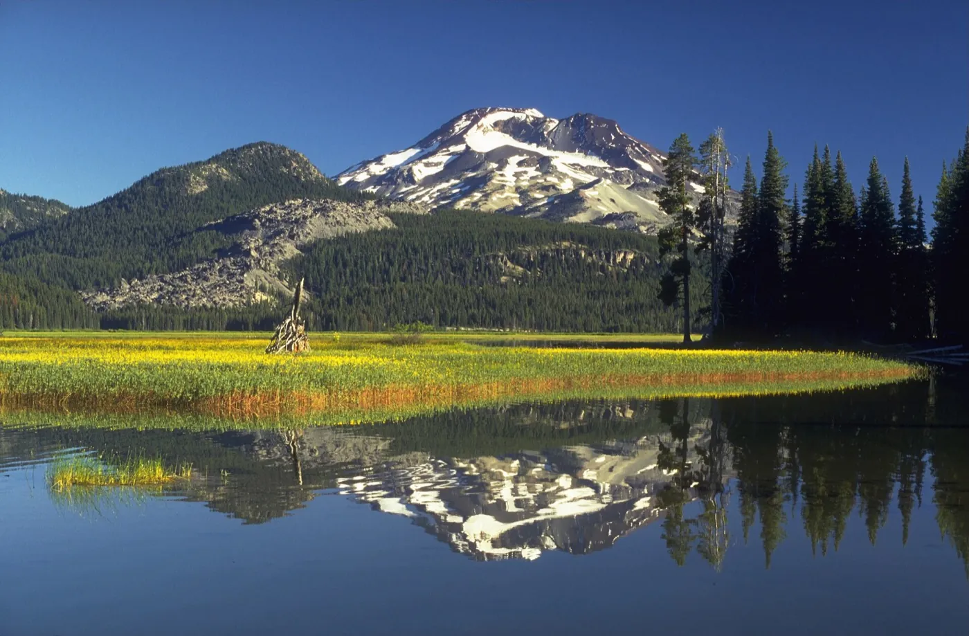
South Sister above Sparks Lake in summer. Photo: USGS Cascades Volcano Observatory, 1995, public domain, via Wikimedia Commons.
This is Stage 6, the first walk-up peak: a summit with no rope and no crampons, in summer. South Sister is the classic first big summit in Oregon.
What do I need to know about South Sister?
- The route. The South Sister climb from Devils Lake is about 12 to 13 miles round trip with about 5,000 feet of climbing, and most people take 8 to 10 hours. The first miles are easy forest trail up to the open Wickiup Plain. Past Moraine Lake it gets steeper, up to a small green lake below the Lewis Glacier at about 8,700 feet. The last 1,400 feet or so is steep, loose red cinder, where you slide back a little with every step. At the crater rim, walk about a third of a mile around to the true summit on the far side. The crater holds Teardrop Pool, the highest lake in Oregon. The summit is 10,358 feet, though Timberline Mountain Guides' South Sister page prints 10,385. In summer it's a hike with no rope, but bring crampons and an ice axe if snow remains near the top.
- The trailhead. The Devils Lake and South Sister trailhead is 29 miles west of Bend on the Cascade Lakes Highway. That's about 45 minutes to 1 hour from Bend. The big paved lot fills early on summer days, so start at dawn. The South Sister Climber Trail now passes under the highway, using the underpass on the Elk-Devils Trail. Some trails often stay snow-covered into late June. Fires are not allowed above 5,700 feet in the Three Sisters Wilderness.
- The permit. From June 15 to October 15, you need a Central Cascades Wilderness permit even for a day climb. The day-use permit costs $1 per person, and you book it on the Recreation.gov day-use permit page. Each day-use permit is good only for the date and trailhead on it, and can't be transferred. The Forest Service quota for this trailhead is 150 people a day, from its March 2026 quota sheet. Of those, 60 are released 10 days ahead and 90 are released 2 days ahead, at 7 am Pacific time. You also need a recreation pass at the lot, $5 per vehicle per day or $30 a year.
- The risks. Basically, the hard part of South Sister is the size of the day: about 5,000 feet of climbing and 8 to 10 hours. The summit ridge is often very windy and cold, even in August, so carry warm layers. Deschutes County search and rescue has been called out for South Sister several times in recent years. Often the hikers ran out of water, got too cold or weren't ready for the day. Carry the Ten Essentials from the list above.
What other Oregon peaks fit Stage 6?
- Mount McLoughlin (9,495 feet). Above the trees, the Mount McLoughlin trail crosses boulders marked by painted arrows, cairns and poles. The Forest Service warns that people often lose the trail on the way down. Searches for lost hikers on the McLoughlin descent still happen, including one in 2024. So on the way down, keep to the ridge and follow the poles. In my view, McLoughlin makes a good second Stage 6 peak, with about 4,000 feet of climbing instead of South Sister's 5,000.
- Mount Thielsen (9,182 feet) is not a beginner peak. The Mount Thielsen trail is about 9.4 to 10 miles round trip with 3,782 feet of climbing. The first 3.5 miles is an even forest grade, then a loose pumice and scree slope leads to the base of the summit spire. The last pitch is steep, exposed rock that you climb with your hands, and a fall there would likely be fatal. Climbers rate it anywhere from class 3 to low class 5, and about half of them use a rope. Basically, that means real rock climbing. Most climbers describe that last pitch as about 80 feet, while the Forest Service puts the hand-over-hand section at the last 200 feet. The Forest Service rates the route a class IV to 5.1 scramble. It says more people have died on this route than on all the technical routes in the Umpqua National Forest combined. People often wait their turn on the ledge at the base of the spire. The spire is famous for lightning strikes, so skip the summit if storm clouds build. So I put Thielsen in the gap between Stage 6 and Stage 7. The trailhead is about 1.5 to 2 hours from Roseburg, and parking is $5 per vehicle per day.
You're ready for Stage 7 when you can finish a long summit day with energy left, and you've decided you want to learn snow and glacier travel. That check is my own suggestion.
Stage 7: Where can I learn snow and glacier skills in Oregon?
This is Stage 7, snow and glacier skills: a course in crampons (metal spikes for your boots), an ice axe and rope work. Basically, this is the first stage that costs real money. A crevasse is a deep crack in a glacier. Self-arrest means stopping yourself with an ice axe after a slide on snow.
What do Oregon snow courses cost?
So here is what each Oregon snow course costs and covers. Prices change, so check the linked page before you book.
| Course | Price | What it covers |
|---|---|---|
| Kaf Adventures Mt. Hood Skills Course | $299 | One day on Mount Hood, 8 am to about 4 pm, in spring and summer. It covers crampon and ice axe technique, basic knots and rope handling, self-arrest, steep slope travel and an introduction to anchors. The Skills Course is not a summit climb. It runs up to 6 students per guide, with a minimum of 3. Rentals per day are crampons $25, ice axe $15, helmet $15 and glacier harness $25. Kaf doesn't rent boots, so rent those at The Mountain Shop in Portland. |
| Timberline Mountain Guides Steep Snow Climbing Clinic | $355 per person in an open group. Private: $575 for 1 person. | One day on Mount Hood's south side at 6,000 to 7,000 feet. It covers footwork, ice axe and crampons on steep snow, rope systems and self-arrest, both roped and unroped. Timberline Mountain Guides requires excellent physical fitness for the clinic. Rental gear is available only in May, June and July. |
| Mazamas Basic Climbing Education Program | 2026 tuition: $940 for members, $1,170 for non-members | An 8 week course run by a Portland nonprofit club. It covers glacier travel, ice axe self-arrest, judging avalanche danger, map and compass, and top-rope climbing, where the rope runs from above you. It also covers belaying, which means handling the rope that catches a partner's fall, and rappelling, which means sliding down a fixed rope. Expect a 3 hour session every week plus homework and full-day field sessions, and you can't miss a session. You must be 15 or older by the first lecture. As a fitness guide, the Mazamas suggest you can carry a 25 pound pack from the Dog Mountain trailhead in Washington to the top in 2.5 to 3 hours. Admission is by lottery, and the Mazamas say applicants usually outnumber spots by 25 to 50 percent. The BCEP page says February to May, while the education page says March to April, so check both. |
| Santiam Alpine Club Mountain Climbing School | $225 | Held each spring. The school has two field sessions. The rock session is at Horsethief Butte in Washington's Columbia Hills Historical State Park. The snow session is at Timberline Lodge on Mount Hood. Topics include self-arrest, rope team travel, anchors (points in the snow or rock that hold the rope), glacier travel and crevasse rescue. The school takes 25 students, first come, first served. |
For a next course after the first one, Kaf Adventures runs Crevasse Rescue Fundamentals for $239, a one-day class held in a city park in Portland or Seattle. Timberline Mountain Guides runs a Crevasse Rescue Clinic at $575 for 1 person, and Anchors and Belay for Steep Snow Climbs at $575 for 1 person. The Mazamas also run a longer Intermediate Climbing School, $1,875 for members and $2,150 for non-members for 2026 to 2027. The Intermediate Climbing School requires three successful climbs in the past three years, so it's the step after the basic course, not a first course.
Should I rent gear for the course?
In my view, yes. Renting first is the smart move, and it matches my start from zero guide. Kaf Adventures' rental prices are in the table above. The Mountain Shop in Portland rents a summer mountaineering package of synthetic boots, crampons, an ice axe and a helmet. The package costs $35 for 2 nights and $10 for each extra night. The Mountain Shop moved in 2025 to 1205 NE 33rd Avenue, and its rental desk is downstairs. Reserve online at least 48 hours ahead, or walk in and take what's left.
You're ready for Stage 8 when you have taken a snow course, can self-arrest without thinking, and feel comfortable in crampons. That check is my own suggestion.
Stage 8: How do I climb Mount Hood with a guide, and where do I go next?
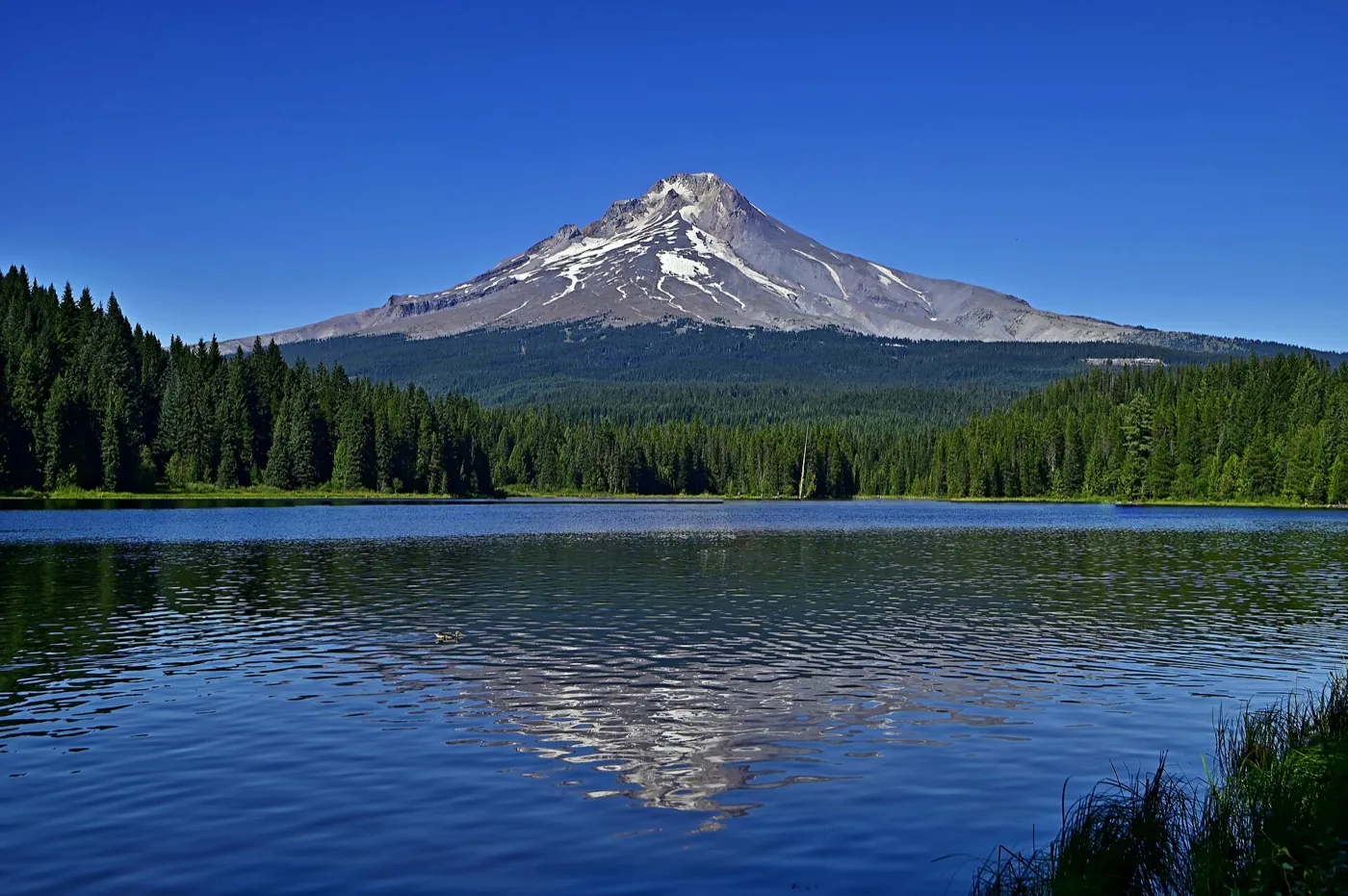
Mount Hood above Trillium Lake. Photo: Kevin Crosby, 2024, CC BY-SA 2.0, via Wikimedia Commons.
This is Stage 8, guided bigger peaks. Mount Hood is Oregon's guided glacier climb. Its summit is about 11,240 feet, though sources differ by about 10 feet. Timberline Mountain Guides' own page prints both 11,239 and 11,249.
Is Mount Hood safe for a first technical climb?
No. The manager of the Forest Service's Mount Hood climbing ranger program said this in an Oregonian podcast in 2024. Every route to the summit is a technical climb, and Mount Hood is not a good first technical climb for really anyone. Basically, a technical climb is one where you need crampons, an ice axe and the skills to use them. So I put it at Stage 8, after a Stage 7 course, never at Stage 6.
On the usual south side route, most parties now finish up the Old Chute, a narrow, steep snow gully where a fall is very hard to stop. You pass Devil's Kitchen on the way, where steam vents smell of rotten eggs. Portland Mountain Rescue warns that clear weekend days in May and June bring hundreds of climbers into those narrow chutes, and it advises newer climbers to go on weekdays.
The Forest Service's fall 2026 climbing statement, issued September 8, 2026, says the climbing rangers do not recommend attempting a summit climb this fall because of thin snow cover. It says rockfall is the primary mountain hazard until snow and ice cover the loose rock. It also lists open crevasses, icefall, fast-changing weather, and avalanche danger in any month at high elevations. It says long, sliding falls have produced many injuries and deaths on Mount Hood. And it says there are no emergency medical services on the mountain, so help may be hours or days out. Regular condition reports resume in spring 2027, with periodic updates through fall and winter, on the climbing conditions report page.
Climbing season runs from mid to late spring through early summer, and for most people April through June. Start in the middle of the night and be off the upper mountain before the sun warms it, because rockfall and icefall pick up as it warms. The Northwest Avalanche Center's Mount Hood forecast is the other page to check. The Northwest Avalanche Center issues daily avalanche and mountain weather forecasts from early winter through spring.
What permit does Mount Hood need?
- The Forest Service's Mount Hood climbing page says a Mt. Hood Climbing Permit is required for all travel above 9,500 feet, all year. The climbing permit costs $20 for 3 days or $50 for a year, bought on Recreation.gov. There's no advance reservation and no daily limit on Mount Hood climbing permits.
- One person can buy climbing permits for a whole party, but at least one member must carry copies of every permit above 9,500 feet. The climbing permit does not cover parking. From November 1 to April 30, the Forest Service says an Oregon Sno-Park permit is required at all sno-parks except Billy Bob Sno-Park.
- The Forest Service asks you to fill out a climbing register form at the Climbers' Registration area at Timberline, near the Wy'East Day Lodge. Nobody checks those forms, so leave your plan with someone at home too. Free WAG bags, which are bags for packing out human waste, are there too. The group limit is 12. The Forest Service also says not to walk up or down the groomed ski runs of the Palmer snowfield in spring and summer.
- Older guides and videos still say the permit is free and self-issued. That was true before 2024. The Forest Service's current page is the one to follow. The Timberline Trail is different, because it still uses a free wilderness permit, as in Stage 5.
Which guide companies run Mount Hood summit climbs?
The ranger program manager in that same podcast named Timberline Mountain Guides and Kaf Adventures as the two key guide services on Mount Hood. Here is what each trip costs and includes.
| Guided climb | Price | What it is |
|---|---|---|
| Timberline Mountain Guides Mount Hood Summit Program | $1,175 open group. Private: $1,375 per climber for 2 or more, $1,675 for 1. The Silcox Hut version is $1,575 open group, $1,775 private for 2 or more, $2,375 private for 1. | Two days on the south side, with dates from April 19 to June 25, 2027. There are 3 climbers per guide at most. A snowcat, which is a tracked snow vehicle, takes you to about 8,000 feet. The climb is about 3,500 vertical feet over about 3.5 miles, 4 to 5 hours up and 4 to 5 hours down. About 4 hours of snow training come first. Timberline Mountain Guides asks that you can hike or climb 8 to 10 hours with 20 to 40 pounds, gaining about 4,000 feet a day. There is no guarantee of reaching the summit. There's no refund or date change for weather once the trip begins. A 20 percent deposit is non-refundable. |
| Kaf Adventures Mt. Hood Summit Climb | $729 in a group. Private for 2 climbers: $829. Private for 1 climber: $1,229. | One day of about 12 hours, meeting at 1 am and back about 1 pm, in spring and summer. There are 2 climbers per guide. You need the Mount Hood Skills Course or equal experience from the last 5 years, and you must be able to self-arrest. You also need to hike 10 to 12 hours and climb 5,000 feet with a 30 pound pack. |
Both companies get strong reviews from past clients, who mostly praise the guides. Kaf Adventures averages 5.0 on TripAdvisor from 99 reviews across all its trips. Timberline Mountain Guides averages 4.7 on Yelp from 14 reviews and 4.9 on Facebook from 31.
Keep in mind that neither company can promise a summit, because weather, snow conditions and the team's pace decide how the day goes.
The Forest Service's Mount Hood climbing ranger program manager explains the new permit and the mountain's hazards.
- The permit: He says the new climbing permit began January 1, 2024, and the fees pay for the climbing ranger program. The prices he gives match the Forest Service's current page.
- The hazards: He lists rockfall, icefall, sliding falls, glacier features, steam vent holes and avalanches.
- Crowding: He says about 10,000 people attempt the climb in a year, and some spring days put hundreds of climbers in a small area.
- Where to start: He says climbers should start on other mountains first, and a guided trip is a good way for newer climbers.
Volunteers from Portland Mountain Rescue, a nonprofit group, explain the south side route and when to climb it. This is their opinion, and it is from 2021.
- The route: They describe steep, consolidated snow of about 20 to 45 degrees, with 5,200 feet of gain over about 3.5 miles.
- The timing: They say to leave the trailhead between 11 pm and 2 am. They say to be off the summit by 11 am in spring and early summer, because rockfall and icefall increase as the mountain warms.
- The gear: They say to carry an ice axe, helmet and crampons.
- The rescue note: They say the group is sent out through the Clackamas County Sheriff, and that you can't reach them directly. You call 911.
- Out of date: The video says the climbing permit is free and self-issued. That is no longer true, so use the permit details above.
Where do I go after Mount Hood?
So the next step is my opinion, built on the facts below. In my view, the natural next peak is Mount Rainier in Washington, at 14,410 feet. Like Mount Hood, Rainier is a Cascade volcano covered in glaciers, and the National Park Service says glacier travel rope skills are required there. A Stage 7 course and a Mount Hood climb practice the same rope and glacier skills. Rainier's Paradise area is also about 3 to 3.5 hours from Portland, so check a map. That's my suggested order, not a rule, and no one needs Rainier before anything else.
- Park Service rules. The Rainier climbing registration fee is $82 per person. A wilderness permit is $12 per person per night from May 1 to September 15, and is required even if you aren't camping. The Park Service says climbers must be in excellent physical condition and well prepared, and need technical glacier travel and rope skills. For solo climbers, it suggests many Rainier climbs as part of a team, or climbs of other peaks heavily covered in glaciers, such as Mount Baker. Park entry is $30 per private vehicle for 7 days, or $15 on foot or by bike, on the fees page.
- RMI Expeditions. The Four Day Climb is $2,595 to $2,995, and RMI doesn't say what sets the price. RMI claims no technical climbing experience is needed, with 2 climbers per guide and a summit day of 10 to 14 hours. RMI plans on a 40 to 45 pound pack on the hike up to Camp Muir, and asks for any required medical documentation. The Five Day Climb is $3,095 to $3,595.
- Alpine Ascents International. The 3-Day Muir Climb for 2027 is $3,750 with 2 climbers per guide. It runs from April 25 to September 6, 2027, and many dates have already sold out. Alpine Ascents expects at least 1,000 to 1,200 vertical feet per hour over several hours, and you must be able to carry a 40 pound pack.
- International Mountain Guides. The 3½ Day Summit Climb up the Disappointment Cleaver is $3,395 from June 14 to August 15 and $2,895 outside those dates. It runs 2 climbers per guide, and IMG says "we make no guarantees." The IMG price doesn't mention the registration fee.
- Mount Adams, Washington. The South Climb is about 12 miles round trip with about 6,700 feet of climbing to 12,276 feet. The trail ends near 8,500 feet, and above that it's a rough climbing route on snow and scree that changes with conditions. Most climbers camp at Lunch Counter, and the false summit at Piker's Peak takes longer to reach than it looks. Plan at least 6 to 8 hours up and another 4 to 6 down. The last 3 miles of road to the trailhead are very rough, so a high-clearance car helps. A Mt. Adams Climbing Pass is required above 7,000 feet from May 1 to September 30, sold only online on Recreation.gov, so check the current price there.
- Mount Baker, Washington. The Park Service names Mount Baker as a good glacier peak to climb before a solo Rainier trip. Mount Baker is 10,781 feet, and Timberline Mountain Guides runs a 4-day alpine skills course there for $2,500 for 1 person or $1,700 each for 2 or more. The Baker course requires previous alpine climbing experience. The Mount Baker link goes to that course page.
Now for the bigger picture, in my view. Colorado's walk-up 14,000 foot peaks, listed on 14ers.com, and Kilimanjaro teach altitude without the rope skills that glaciers need. Both are good goals. My Kilimanjaro vs Everest Base Camp guide compares two good first big trips. And the 14 peaks over 8,000 meters shows what sits above them.
You're ready for Stage 9 when you've done a guided glacier climb, and you want to look at what the highest mountain really takes. That check is my own suggestion.
Stage 9: Is there anything Oregon-specific about Everest?
No. This is Stage 9, Everest, and it's the same for everyone wherever you live. My Everest cost page covers fees and company prices. My page on the 14 peaks over 8,000 meters covers the other giants and which one people climb before Everest. Nobody can promise any summit.
Which Oregon clubs and resources help along the way?
- Mazamas, Portland. A nonprofit club that runs hikes, climbs and courses, including the education program in Stage 7. New members pay a $25 setup fee and get up to 20 percent off education courses. The annual dues aren't posted online, so call (503) 227-2345.
- Obsidians, Eugene. The Obsidians have been around since 1927, and the club teaches hiking, backpacking, mountain climbing and more. The club has a climbs calendar. Each spring the Obsidians run a Basic Climb School with snow and rock sessions, ending in climbs of Diamond Peak and Mount Thielsen. In 2026 the Basic Climb School cost $120 for members and $170 for others, with room for 24 students, and membership was $50 a year.
- Santiam Alpine Club. Climbers in Salem started the Santiam Alpine Club in 1959. The club runs the spring climbing school in Stage 7, plus follow-up sessions in summer.
- Oregon Hikers Field Guide. A wiki written by volunteers, with distance, gain and trip reports from people who just hiked the trail. The trip reports are the best way to check snow, mud and crossings before you go.
- Portland Mountain Rescue. A nonprofit volunteer rescue group. In the 2021 talk above, its volunteers say they are sent out through the Clackamas County Sheriff's Office. Portland Mountain Rescue's own site says to call 911 right away in an emergency.
What's next?
So the next page on the path is my Kilimanjaro vs Everest Base Camp comparison, a good first big trip after Mount Hood or Rainier. If you want to look further up, read what it costs to climb Everest. And if you're still at Stage 1 to 3, my start from zero guide has the whole ladder.
My take
So ultimately, you can do Stages 1 through 7 in Oregon, starting with a one-mile trail like Silver Falls and building to South Sister. Take a snow course on Mount Hood before you try its summit with a guide. Then Rainier in Washington is the next peak I'd look at.
But for me personally, I'd rent the gear for your first course, and I'd leave Mount Thielsen until a guide or a club has shown you the route. And if any one stage is as far as you want to go, that's a fine place to stop.
Have a question about “How do I get from a first hike to Mount Hood and beyond if I live in Oregon?”?
Ask it here. Every question comes to me first. I answer as many as I can, and each answered question goes on this page with my answer so other hikers and climbers can see it too. I don't ask for your email, so check back on this page for the answer.
More by state guides
- Photo of South Sister above Sparks Lake: USGS Cascades Volcano Observatory, 1995, public domain, Wikimedia Commons.
- Photo of Mount Hood above Trillium Lake: Kevin Crosby, 2024, CC BY-SA 2.0, Wikimedia Commons.
- US Forest Service: passes (October 5, 2026), Climbing Mount Hood (August 5, 2026), the Mount Hood climbing statement (September 8, 2026) and condition reports, Timberline Trail (August 28, 2025), Central Cascades Wilderness permits (April 8, 2026) and its March 2026 quota sheet, all checked October 18, 2026.
- US Forest Service trail pages, checked October 18, 2026: Devils Lake and South Sister, Green Lakes and Soda Creek, Angels Rest (September 25, 2025), Mount McLoughlin (September 17, 2026), Mount Thielsen (August 17, 2026), Strawberry Mountain Wilderness (May 4, 2026), Marys Peak North Ridge Trail (August 3, 2026), Marys Peak Day Use (August 18, 2026), Dog Mountain, Eagle Cap Wilderness (January 6, 2026) and Mount Adams South Climb (December 23, 2025).
- US National Park Service, checked October 18, 2026: Mount Rainier climbing (July 8, 2026), Rainier fees (September 1, 2026), Rainier directions (September 11, 2026), Crater Lake hiking (October 24, 2023), Crater Lake fees (April 22, 2024), Painted Hills trails (September 24, 2024) and The Ten Essentials (May 28, 2026).
- Other agencies, checked October 18, 2026: the CDC's Yellow Book chapter on high altitude (April 23, 2025), the BLM's Table Rocks page, Silver Falls and Smith Rock from Oregon State Parks, the Oregon Department of Transportation's Sno-Park permits, Portland Parks' Forest Park, the Northwest Avalanche Center's Mount Hood forecast, InciWeb, the Recreation.gov Devils Lake day-use permit and Central Cascades overnight permit pages, Washington State Parks' Columbia Hills Historical State Park, Portland Mountain Rescue and the Clackamas County Sheriff's Office.
- Guide companies, schools and clubs, checked October 18, 2026: Kaf Adventures' Skills Course, Summit Climb and Crevasse Rescue Fundamentals, Timberline Mountain Guides' Summit Program, Steep Snow Clinic, Anchors and Belay, Crevasse Rescue Clinic, South Sister Hike and Kulshan 4-Day Alpine Skills, the Mazamas BCEP, education, ICS and membership pages, the Santiam Alpine Club school, Obsidians, The Mountain Shop's rentals, RMI Expeditions, Alpine Ascents and International Mountain Guides, plus Timberline Lodge and 14ers.com.
- Volunteer guide, checked October 18, 2026: the Oregon Hikers Field Guide pages for South Sister, Mount McLoughlin, Angels Rest, Misery Ridge and Strawberry Mountain.
- Videos, checked October 18, 2026: The Oregonian's Peak Northwest podcast (April 2024) and The Mountain Shop's talk with Portland Mountain Rescue (March 2021).
- More official pages, checked October 18, 2026: Portland Parks' Lower Macleay Trail accessibility assessment (May 31, 2023), Oregon State Parks' North Rim Trail opening release (July 28, 2023) and 2026 parking fee release (February 20, 2026), the BLM's Upper Table Rock reroute release (November 9, 2023), the Park Service's John Day Fossil Beds fees and Crater Lake road opening dates, the Forest Service's Woods Creek Trailhead (February 12, 2026), Two Pan Trailhead and Mount Adams summit pages, and Portland Mountain Rescue's Mount Hood climbing season tips.
- Hiker and climber reports, read October 18, 2026: Oregon Hikers Field Guide pages and forum trip reports for Lower Macleay, Trail of Ten Falls, Upper Table Rock, Marys Peak North Ridge, Mount Scott, Mount Thielsen, Strawberry Mountain from Roads End, Green Lakes and Ramona Falls (2012 to 2026). AllTrails reviews for Upper Table Rock (2,371 reviews), Angels Rest (13,532), Misery Ridge (11,199) and Marys Peak North Ridge (511), reading the most recent reviews from May to October 2026. SummitPost climbers' logs for Strawberry Mountain, Mount McLoughlin, Mount Scott, Mount Thielsen and Mount Hood (2009 to May 2026). WTA's Trail of Ten Falls and Mount Adams South Climb pages and trip reports (2022 to 2026). Steph Abegg's South Sister trip report (October 2025), The Mountain Shop's South Sister trip report (June 2024), the Bend Bulletin on Green Lakes (September 2024), The Nugget on South Sister rescues (April 2026), KOBI-5 on a lost McLoughlin hiker (September 2024), OPB on the North Rim Trail (July 2023), Willamette Week on The Mountain Shop's move (June 2025), McKenzie River Reflections on the Obsidians Basic Climb School (February 2026), and review totals for Kaf Adventures and Timberline Mountain Guides on TripAdvisor, Yelp and Facebook.
- Stage 1 walks by region, official pages checked October 18, 2026: Portland Parks' Powell Butte Nature Park, the Tualatin Hills Park & Recreation District's Tualatin Hills Nature Park, the City of Salem's Minto-Brown Island Park, the City of Eugene's Delta Ponds Loop and Delta Ponds facility page, Willamalane's Dorris Ranch and park rules (July 8, 2026), the City of Corvallis' Bald Hill Natural Area, Bend Park & Recreation District's Deschutes River Trail, Old Mill and Riverbend Park, Oregon State Parks' Pilot Butte and Shore Acres, the City of Redmond's Dry Canyon Trail, the City of Ashland's Lithia Park, the City of Grants Pass' Reinhart Volunteer Park and hiking trails pages, Pacific Power's Link River Trail closure release (March 16, 2026) and its reopening release (April 9, 2026), the Klamath Trails Alliance trail map, the City of Roseburg's Umpqua River trail map (May 2, 2022) and parks FAQ, the BLM's Yaquina Head page and brochure, the Park Service's Netul River Trail (June 28, 2021), Lewis and Clark fees (September 4, 2025) and Oregon Trail Interpretive Park pages, the City of Pendleton's Pendleton River Parkway, and the Hells Canyon Scenic Byway listing for Blue Mountain Crossing.
- Stage 1 walker reports, read October 18, 2026: Oregon Hikers Field Guide pages for Powell Butte (2026), Tualatin Hills Nature Park (2026), Minto-Brown (2023), Dorris Ranch (2023), Bald Hill (2026), Pilot Butte (2023), Dry Canyon (2024), Lithia Park (2026), Link River (2026), Moore Park (2026), Stewart Park (2018), South Umpqua Riverfront (2021), Yaquina Head (2023) and Shore Acres (2025), plus a Link River trip report (September 2018). AllTrails pages for Delta Ponds (about 355 reviews), Dorris Ranch (702), Bald Hill via the Midge Cramer Path (365) and Stewart Park (35), read through their review summaries. HikeSpeak on Powell Butte (December 2025) and Pilot Butte (December 2025), a CycleBlaze visit to Powell Butte (March 2026), Friends of Powell Butte, the Statesman Journal on Minto-Brown parking (May 2024), KVAL on the Delta Ponds footbridge (January 2024), TrailLink on Bald Hill, TrailLink on the Deschutes River Trail, TrailLink on the Pendleton River Parkway (reviews 2011 to 2021) and TrailLink on the Leo Adler Memorial Parkway, Bend Branches on the Mill A Loop (2018), the Bend Bulletin on Pilot Butte visits (March 2024), KDRV on Lithia Park restrooms (June 2026), Airbnb local tips for Reinhart Volunteer Park (2020 to 2023), the Hiking Project Link River page (2018 check-ins), the Hiking Project Netul Landing page (2021 and 2025 check-ins), Wanderlog's summary of Yaquina Head reviews, an Oregon Shores report on Shore Acres (August 2022) and the Baker City Herald on the Adler Parkway benches (March 2024).
- Wildlife and plant safety, official pages checked October 18, 2026: the Oregon Department of Fish and Wildlife's western rattlesnake fact sheet (Oregon Conservation Strategy), snakes fact sheet for kids, Living with cougars (March 27, 2026), cougar brochure (November 2020), black bear page and black bear brochure (November 2020). The Oregon Health Authority's ticks and tickborne disease page (Lyme data 2022 to 2025), West Nile virus activity page (2026 season) and West Nile release (August 11, 2023). The CDC's venomous snakes (September 23, 2026), poisonous plants (October 1, 2026) and preventing tick bites (August 28, 2024) pages. The Oregon Poison Center's bites and stings page at OHSU. The National Park Service's John Day Fossil Beds safety (September 3, 2024) and Crater Lake safety (September 19, 2022) pages. The BLM's Table Rocks page, Table Rocks rattlesnake handout and Rogue River Trail guide (May 2021). Oregon State Parks' Silver Falls page, the Forest Service's Strawberry Mountain Wilderness page (May 4, 2026), and Oregon State University Extension on yellowjacket nests (August 2026) and poison oak (revised January 2025).
- Wildlife and plant reports from hikers, read October 18, 2026: Oregon Hikers Field Guide hazard notes on the Upper Table Rock (poison oak, rattlesnakes, ticks), Angels Rest (poison oak), Misery Ridge (rattlesnakes), Bald Hill (poison oak), Dorris Ranch, Powell Butte and Minto-Brown (stinging nettle) pages, plus its poison oak, snakes and ticks pages. An Oregon Hikers Angels Rest poison oak trip report (September 3, 2026), AllTrails reviews of Upper Table Rock (August 2026) and Misery Ridge (October 2026), and SmithRock.com's rattlesnake sightings at Smith Rock (June 2015).
Everest Buddy is an independent site. No gear maker, store or guide company paid to be on this page. This guide gives general information, not medical advice, so see a doctor before you start a new training plan or travel to high altitude.